Geological subsurface exploration
Digitisation of seismic sections from paper AS Vector SGY v3.1. Post-stack processing, linking of seismic profiles by area. Digitization of well logging data AS Vector Las v3.1. Normalization of GIS curves, synthetic curves calculation, downhole corrections for borehole measurement conditions. Vectorization of geological materials. Conversion of images from raster format into digital format for further work in specialized programs.
Analysis, synthesis, processing, interpretation of historical materials
Preparation of reports on geological surveys in the Republic of Kazakhstan
Study of the lithological and stratigraphic ranges of sedimentary basins in Kazakhstan from geological and geophysical data
Integration of geochemistry, gravity, magnetic survey and other data processing results with seismic interpretation results
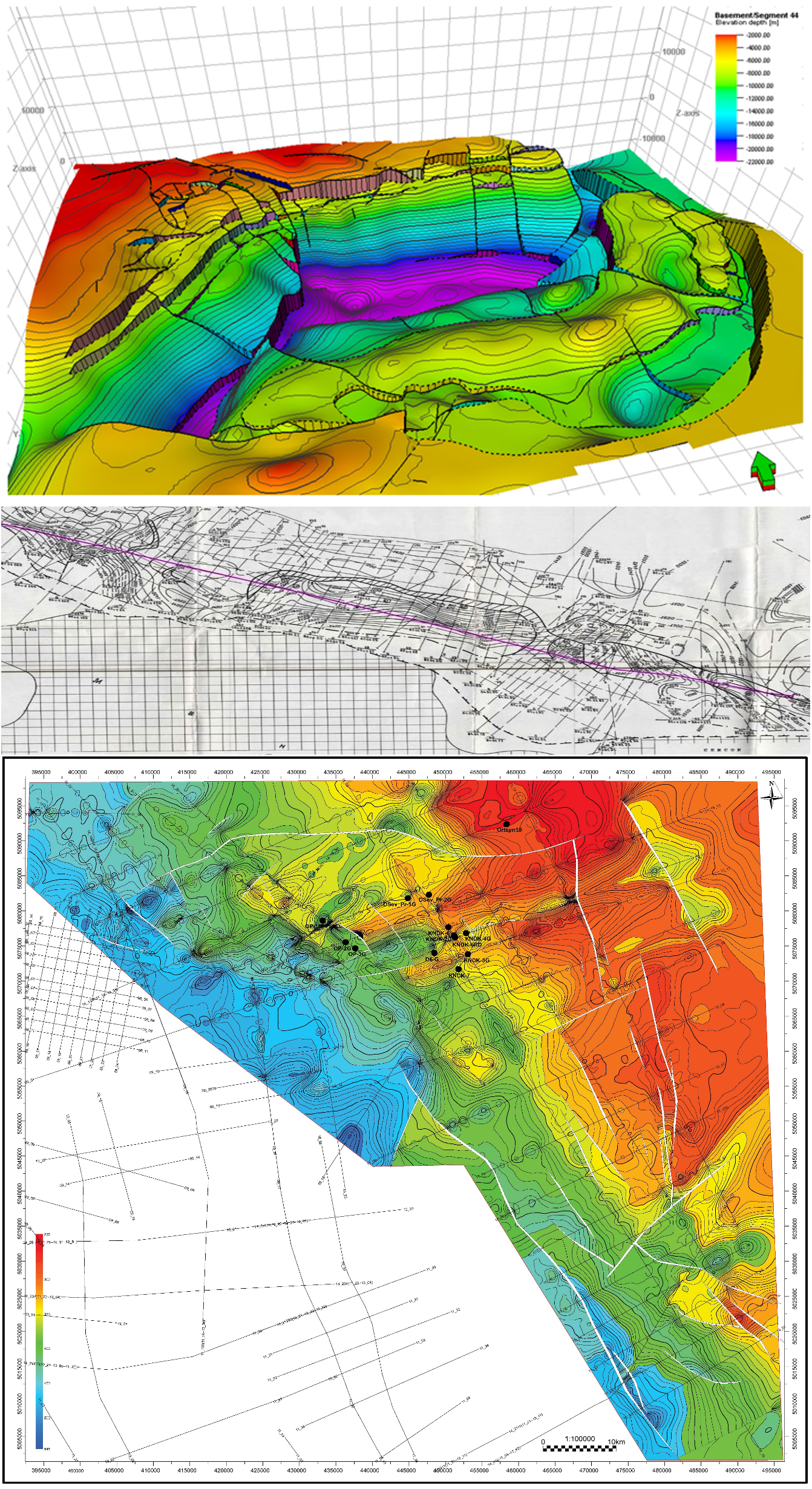
The main tasks of the work performed are to study the conditions for the formation of oil and gas traps, according to the results of which the systematization and forecast of the types of deposits and zones of their development in various paleogeographic and geological settings is carried out; dissection and correlation of geological sections according to a set of data including seismic materials, GIS wells and laboratory core analyses, paleontological/ palynological studies, seismic facies analysis and analysis of seismic attributes, seismic inversion and other methods and techniques; interpretation of sedimentation conditions; construction of digital geological and geophysical models of sedimentary basins, construction of local geological models for identified oil and gas prospective traps; preparation, justification and recommendations of priority objects for setting exploration for oil and gas.